Hamilton’s geography is largely the result of successive depositions of volcanic ash, as well as debris that washed down the Waikato River in at least two major floods caused by ash blocking the mouth of Lake Taupo. In its present form, the landscape emerged about 20,000 years ago (20,000 BP) following the eruption of the Taupo volcano at Oruanui. Dates of the eruption vary. A 2007 study put it between 22.5 and 14,000 years ago. Back in 2004 put it at 26.5 ka. Lake Taupo rose about 145 m (476 ft) above the present lake after the eruption. About 20,000 years ago. ash dam failed and the lake rapidly dropped about 75 m (246 ft), causing severe floods. The ash they carried formed the main surface of Hinuera into an alluvial cone of volcanic ash that extends north from Hamilton and falls about 60 m (200 ft) from Carapiro. At about the same time the Waikato changed its direction and did not flow into the sea near the Thames, perhaps only because of sediment accumulation. Peat lakes and bogs also formed around this time; carbon dating gives a maximum age of 22,500 to 17,000 years. Because of the ice age, vegetation slowly stabilized the ash, so dunes formed up to 25 m (82 ft) above the local Hinuera surface. The present Waikato Valley became debris about 12,000 years ago. and was further modified by the eruption of Hatepe in 181 AD when the level of Lake Taupo dropped again by 34 m (112 ft) causing a flood of 20 km3 (4.8 cubic miles) equivalent to a normal 5-year runoff in just a few weeks. ] About 800 years ago, the river channel began to overgrow about 8 m (26 ft).
With the exception of many low hills, such as those around the University of Waikato, Lake Hamilton, Bereskorta, Sylvester Road, Pukete and west of the city, and an extensive network of ravines, the city’s terrain is relatively flat. In some areas, such as Te Rapa, one old ancient river path can be traced. The relatively soft and loose soil material is still actively eroded by rainfall and surface runoff.
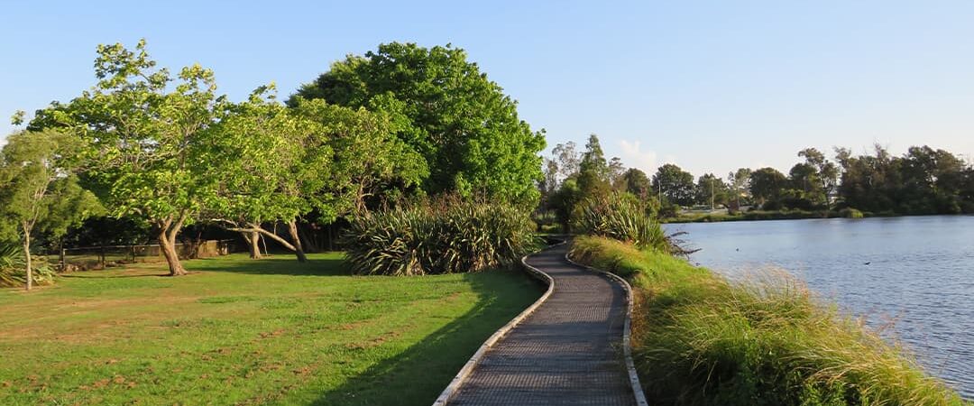
In its natural state, Hamilton and the surrounding area was very marshy in winter with 30 small lakes connected to the surrounding peat bogs. Hamilton was surrounded by 7 large peat bogs such as Komakorau in the north and Rukuhia and Moanatuatua’aua in the south, as well as many smaller bogs, all of which have now been drained with only small remnants remaining. The total area of the peatland amounted to about 655 km2. Early photographs of Hamilton East show carts buried up to their axles in the thick mud. Up until the 1880s, it was possible to row and haul a boat from the town to many remote farms in the northeast. This swampy and wet environment at the time was considered an ideal breeding ground for the tuberculosis bacillus, which posed a serious health hazard in the early days. To avoid this problem, Hamilton’s first hospital was built on a hill. One of the reasons why population growth in Hamilton was so slow until the 1920s was the great difficulty in traversing the many arms of deep swampy ravines that crisscross the city. Hamilton has 6 major complexes of dendritic gullies, of which the 15-kilometer branch is 12, the Kirikiriroa system is in the north of the city, and the southern Mystery Creek-Kaipaki gully complex is the largest. Others are Mangakotukutuku, Mangaonua and Waitawiriwiri.
In the 1930s Garden Place Hill, one of many smaller hills sometimes called the Hamilton Hills, was demolished by unemployed men working with picks, shovels and Ford Model T trucks. The western remnants of the hill are held up by a large concrete wall. The original hill ran from the current Wintec site east to the old post office (now a casino). Land was taken 4 km north to partially fill in the Maeroa ravine adjacent to the Central Baptist Church on Ulster Street, the main road leading north.
Lake Rotoroa (Lake Hamilton) began to form about 20,000 years ago. It was originally part of an ancient river system that was cut off by sediment and became two small lakes separated by a narrow peninsula. Due to more rainfall and drainage from the extensive peat lands to the west, the water level rose, so the narrow peninsula was flooded, forming one large lake. The lake is 8m deep in the north and 6m deep at the southern (hospital) end. The old watershed peninsula, the beginning of which is still visible above the water on the east side, is only 2 m below the surface.